Expanded case study · Seeing change from space
Mapping the destruction of Rohingya villages
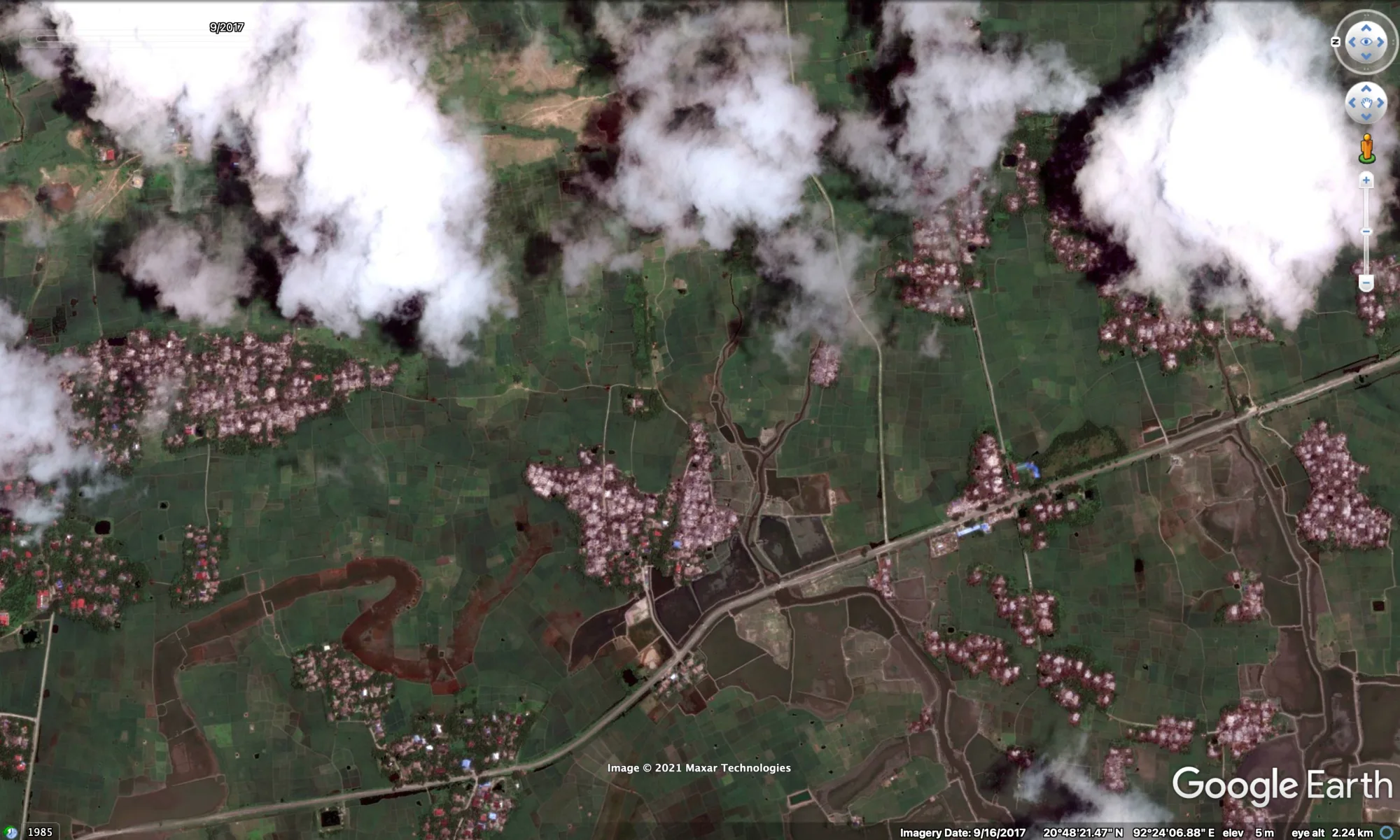
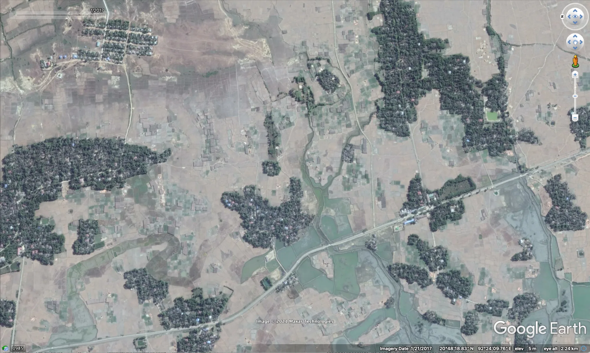
Satellite imagery, fire data and open-source verification were combined to establish which settlements were destroyed, when, and in what sequence, structured building by building rather than reported as an estimate.
The result is a public, queryable evidence base used by researchers, journalists and accountability bodies, and a method that has since been reused in Sudan, Nigeria and Ukraine.
Open the Ocelli Project →