Boko Haram’s systematic destruction and displacement of Nigerian communities
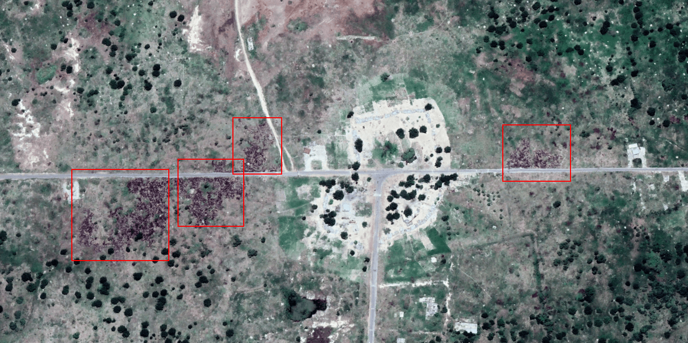
Villages, towns and dense areas have been burnt, destroyed, and completely levelled in northern Nigeria as the country continues its fight against the Boko Haram insurgency.
Using Google Earth’s history function, we can view how landscapes change over years, as well as study developments in infrastructure and refugee movement through conflict areas.
For the northern region of Nigeria, the landscape tells a grim tale.
In Nigeria’s Borno State, what was once a thriving and culturally rich area, is now a void land as the population shelters in siege cities where the frontlines are protected by trenches, literally.
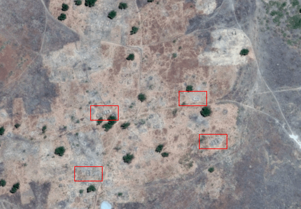
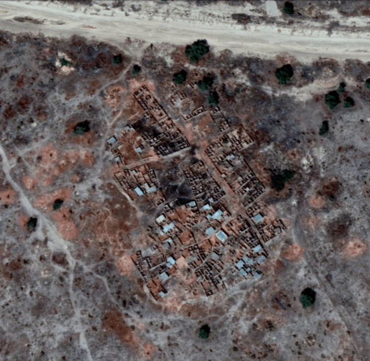
Villages now have only their foundations remaining after they were burnt to the ground.
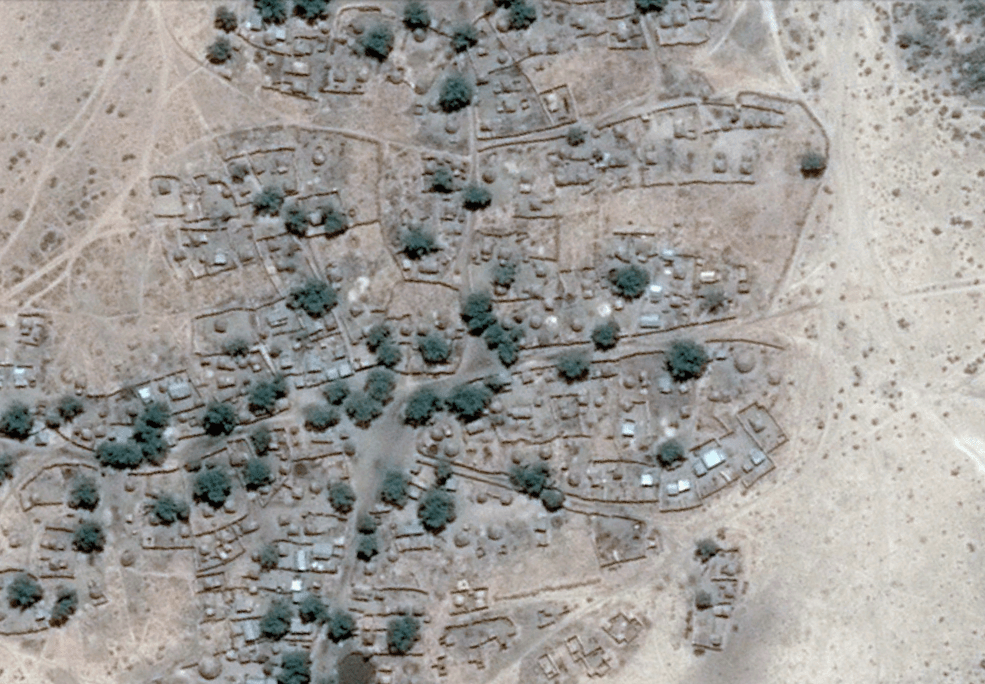
The clear path of destruction mapped out by Boko Haram’s systematic approach to village destruction in Borno State from 2014 to 2017 can be seen as they jump from town to town destroying everything they leave behind.
One roadside village was functioning in February 2016, but by March 2017 only foundations and ash remain. Another scene is the village of Mutube with its surrounding communities: the satellite image from 2013 shows a village, and the next available image from 2017 shows only trees remaining.
For many communities that have been destroyed, there is no hope of rebuilding. That being said, the Nigerian Government is urging some refugees to return home. But there is nothing left, and if there was, it would again be under attack by Boko Haram insurgents still at large in the area.
More recent village destruction can be seen below, where only a few foundations of buildings remain in the space of 11 months since 2017.
Mapping the disappearance of hundreds of sub-communities
Surrounding the Sambisa Forest in Nigeria’s north is where the majority of the evidence of displacement can be viewed. According to UNHCR, that count of displacement is in the millions.
The forest itself covers a very large and difficult terrain where many of Boko Haram’s attacks have been launched from.
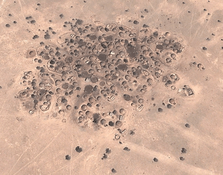
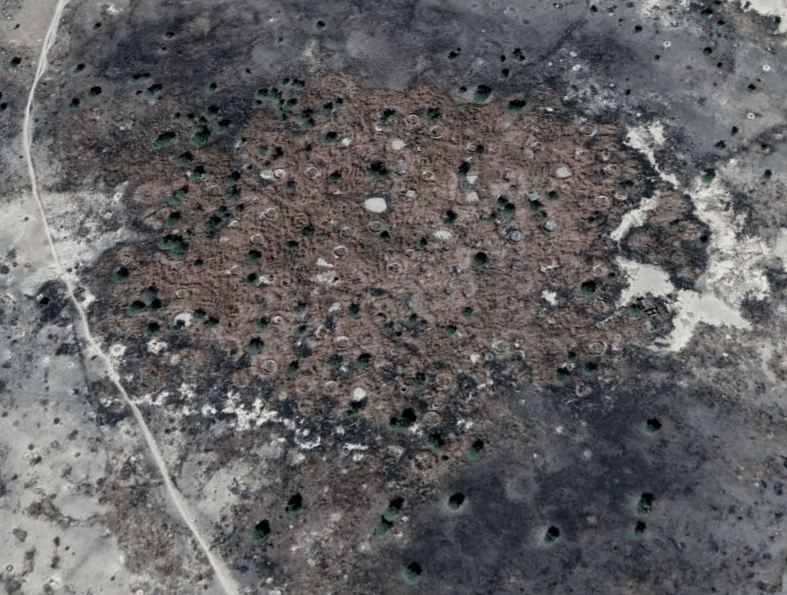
On the outskirts of the forest, traditional villages are all too common a story. When we view their status in the available 2017 map of Google Earth, there are no visible signs of what once stood there. There are hundreds of villages and towns like this that have been erased off the map. Three such communities were destroyed at some point between March and November 2016.
Significantly larger and denser than the small villages, the town of Nguro-Soye was the victim of many suicide bombings and attacks by Boko Haram militants. Attacks on crucial infrastructure such as a telecommunications tower and suicide bombings of the town’s marketplace led to a downfall of Nguro-Soye, and its ultimate destruction. The satellite image from March 2018 shows few remnants after the town’s destruction.
Further south of Nguro-Soye, on a T-intersection of a main road, we are able to see more defined darker areas where villages once stood, indicative of burning. These villages would have also been prime targets given the accessibility of the main highway for Boko Haram and Nigerian military to operate in the area.
In a bid to control this area, the Nigerian military have used their "trench-laying" tactic to fortify the position against suicide bombers. Many of these trenches are scaled at 2 to 4m wide and 2 to 3m deep, and are a quick and effective solution to protect areas against potential suicide bombers or vehicle attacks, two offensive tactics Boko Haram employ.
For villages that have been built along main roads, in a more peaceful time it would have been a good thing. But for villages in northern Nigeria, it means they are more accessible to Boko Haram. Almost all villages constructed along main roads near the major fortified town of Bama were systematically wiped out between 2016 and 2017. This is the case for the small town of Mairamri, 15km south-east of Bama.
More recent destruction occurred at the village of Gajibo in Borno State along the Gamboru Ngala Highway. News reports from July 2018 state 27 were killed in an attack on the village, however, we can see from satellite images that the town has been largely destroyed, bar several shelters.
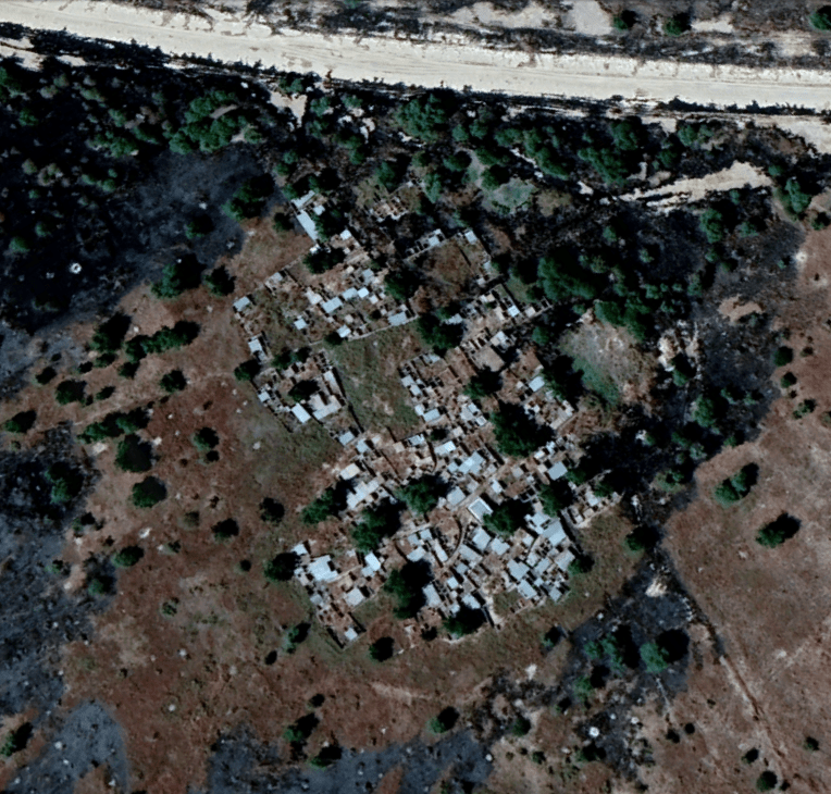
Any villages that are still standing are in the process of being besieged by Boko Haram, or are strongholds of Boko Haram, and face attacks and bombing by Nigerian military. Smoke signals from bombings and attacks are a common story.
Dikwa: the siege city offering refuge
With so much displacement from homes, communities and towns being destroyed, where have the majority of refugees gone? There is evidence in a number of larger towns that have the afforded protection of the siege trench walls and strong military presence.
One such area is the town of Dikwa. Dikwa’s history has seen the town pivoted as a stronghold since the 1800s, and has seen German and French occupancy. Now the town is a well-protected sanctuary of the Borno State. It uses the first line of defence trench system encircling the town.
The only access points in the town are main roads, which are heavily guarded with stringent checkpoints, visible in the satellite image from 2018.
Due to the safety Dikwa is able to provide, it has been established as a refugee-haven for many of the displaced villagers from the outlying areas. We can see this in evidence of the rapidly erected refugee cities in Dikwa. The living conditions in these camps are dire.
The capital of Borno State, and the area’s largest city, Maiduguri, is also a haven for many of the displaced with its well-protected boundaries. Since village destruction began in 2015, Maiduguri has struggled to house refugees. In the space of three years, a refugee city is born.
The millions of displaced Nigerians, referred to as IDPs or Internally Displaced People, only need to look past city defences to see the plight of villages that sit beyond its boundaries. Beyond the protection of Dikwa’s boundary, one small village was levelled between 2016 and 2017.
Bitta: the failed siege town
For the most part, the Nigerian defensive trench is able to protect the towns it surrounds. For Bitta, it was not able to do so.
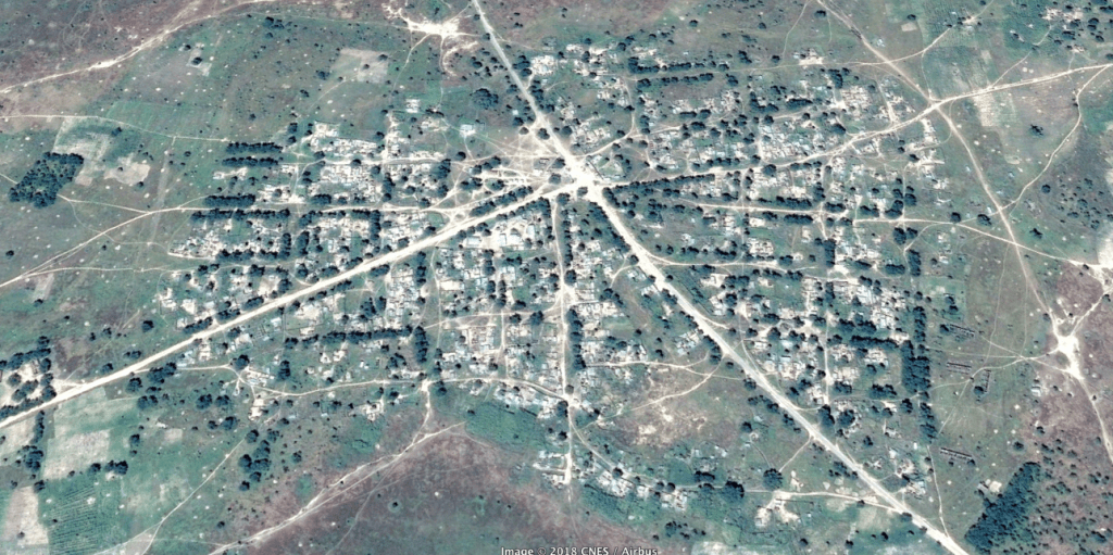
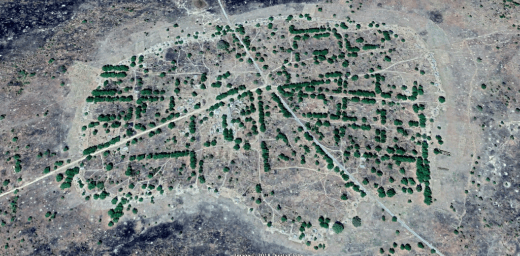
Bitta has been a hotspot for Boko Haram and Nigerian military clashes and many of its citizens have left after its destruction. The military has used Dikwa as a launchpad for the Borno State Nigerian military Deep Punch II Operation, focussing on the clearance of Boko Haram presence in the Sambisa Forest. The scars of clashes can be seen just beyond the guard boxes built along the north edge of the town.
The refugees from villages like Bitta and others are not just moving to Nigeria’s refugee camps, but are also fleeing the danger and seeking refuge in bordering countries such as Chad and Cameroon.
One of the largest external camps for Nigerian refugees is Minawao Refugee Camp in the Mayo Tsanaga region of Cameroon’s Far North. Minawao is exceeding numbers every day. The UN says Cameroon’s Far North region hosts more than 95,000 Nigerian refugees. Many of which are sheltering in Minawao. Since 2014, Minawao has become a city in Cameroon.
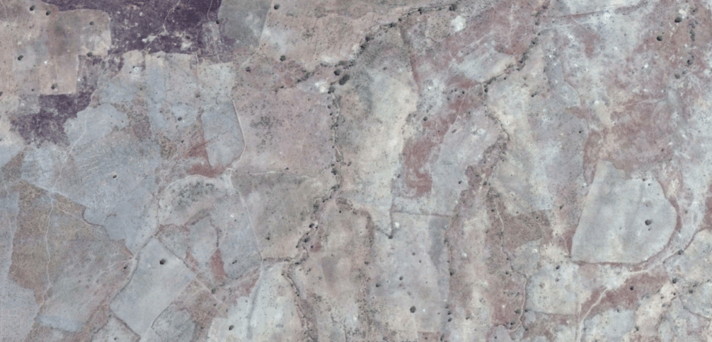
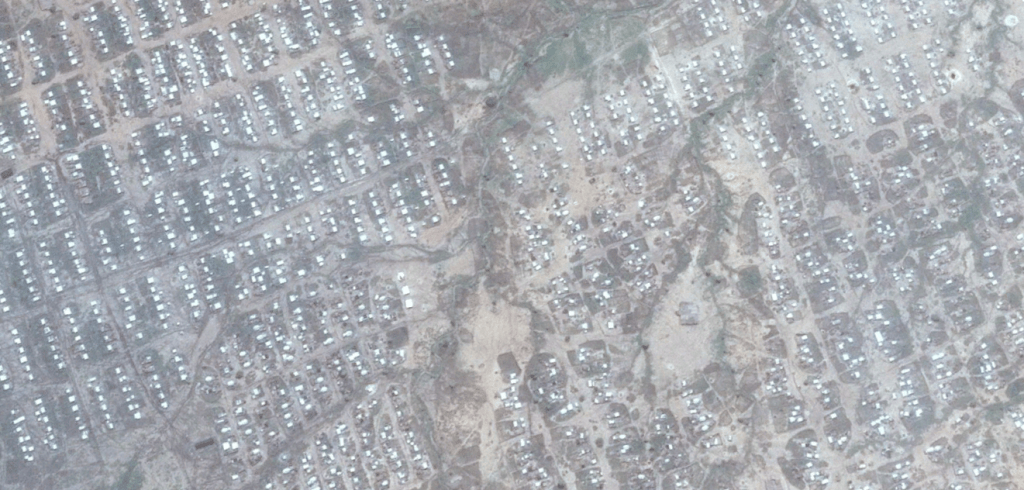
While it did previously pledge a commitment to refugees, the Cameroonian Government has been "forcibly returning" a number of Nigerians. UNHCR say this is a clear violation of national and international laws.
The fight against Boko Haram in 2018 still ensues, as regular attacks are reported against villages in Nigeria’s north, as well as bordering villages in Cameroon.